CLIMBING KATAHDIN
via the Hunt Trail
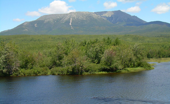 |
| The goal – Katahdin (Baxter Peak), the northern terminus of the Appalachian Trail, as seen from Abol Bridge. Elevation – 5,268 feet. I’m taking the Hunt Trail from the Katahdin Stream Campground in Baxter State Park. The summit is 5.2 miles from and 4,198 feet above the campground. |
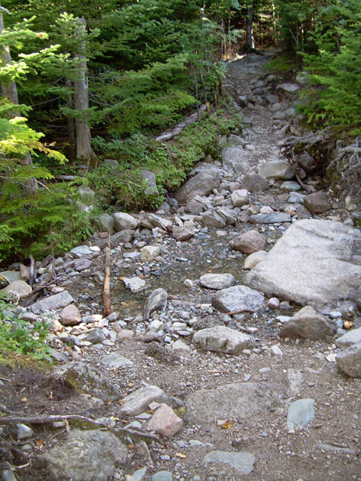 |
| A little over a mile along the Hunt Trail. What's the big deal? Yeah, it's rocky but nothing extraordinary. |
 |
| Ahhhh, that's the big deal -- big boulders. This is pushing the definition of "hiking." Looks more like the riverbed of a Class IV rapids than a trail. |
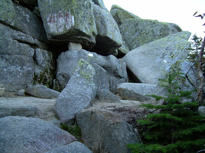 |
| Hitting the wall – a boulder wall -- at the treeline. A brief moment of doubt: “Do I really want to go on?” I had been leapfrogging a family of four all morning and caught a glimpse of them on a ledge high above me. If an adolescent boy and his mother could get up there, I could too. I suppressed the anxiety I feel when I’m near the edge of a precipice without a guard rail and started climbing. This wasn’t hiking anymore. At several places, iron rods had been embedded in the boulders to provide hand and footholds. More than once, after managing to clamber up, I found myself wondering whether I’d be able to get back down. But that was something to worry about later. |
 |
| Between a rock and a hard place – a short level stretch between the top of the boulder wall and the bottom of the ridge up to the tableland. The climb didn’t look too difficult from here. Two miles to go. |
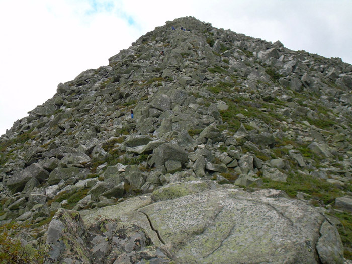 |
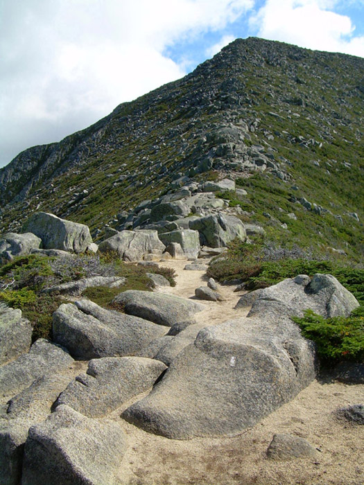
| Up close, it was a different story – the incline was steep and the rocks were huge. Can you spot the tiny blue specks halfway up and near the top of the ridge? Those are people. |
 |
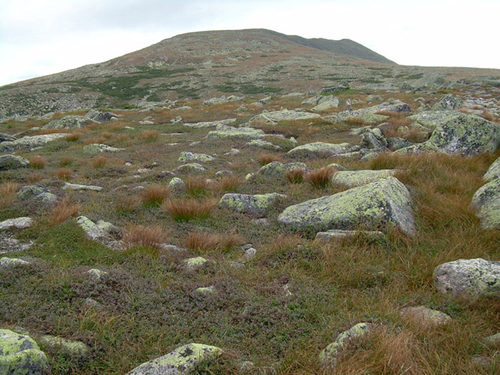
| Over the hump. It was a relief to set foot on the comparatively flat and smooth tableland. |
 |
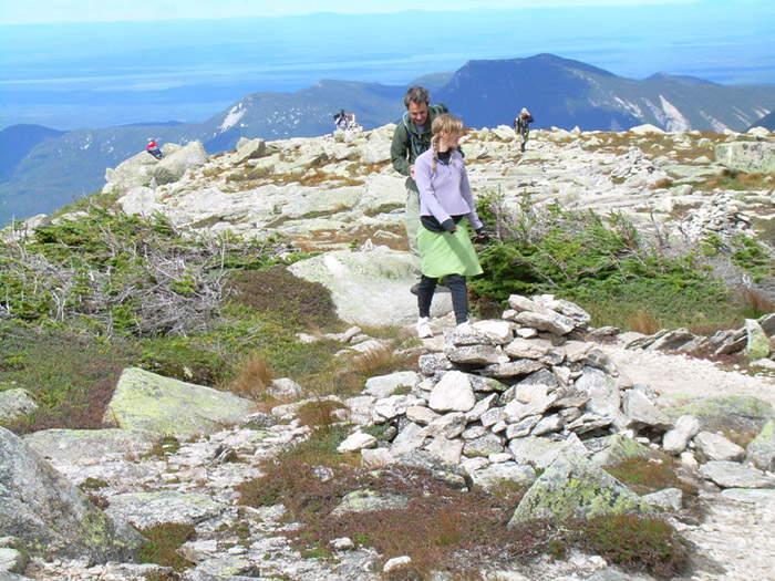
| I was awed by the tableland’s fragile and austere beauty. The following day, as I understand it, two 18 year old SOBOs illegally camped overnight on the tableland. Someone reported them and park rangers were waiting when they climbed down. They were cited, transported out of Baxter Park, and have a court date in December. |
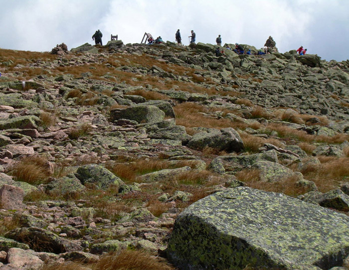 |
| Nearing the summit. Looks like quite a crowd up there. |
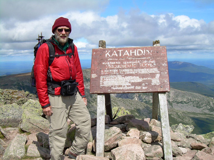 |
It took me five hours but I made it. While taking a break in the shelter of some rocks, I overheard the following conversation between a father and his young (~12 year old) son:
”The last time I climbed Katahdin was five years ago. I’ve been waiting until you were old enough to come with me. We should make this an annual tradition.”
”Daddy, I don’t want to climb up here every year!”
I’m with you kid. |
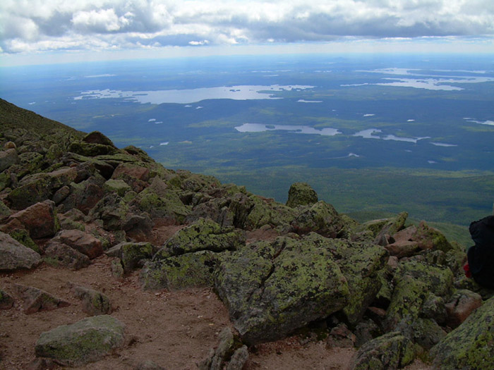 |
| View from the summit. That’s a long way down. My descent took as long as my ascent. Total time from start to finish – 10 ˝ hours. And that was on the easy (Hunt) trail. |
|