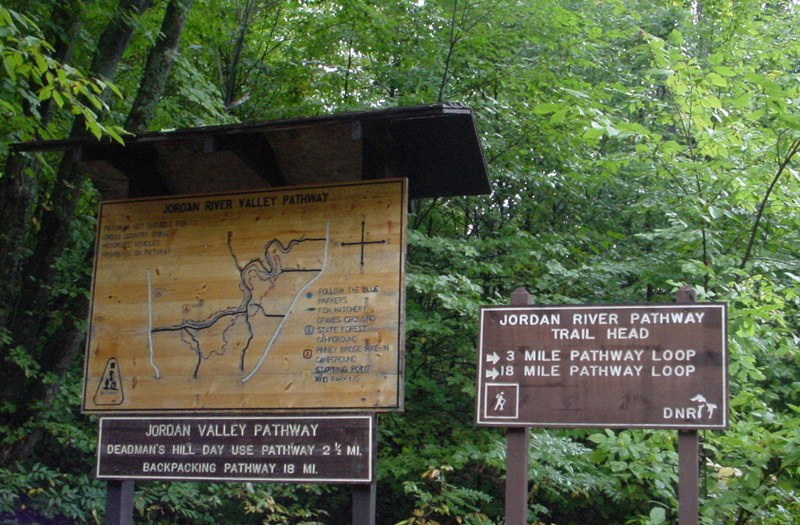
Hiking the Jordan River Pathway
Online maps of Jordan River Pathway -- Map 1, Map 2 -- Old maps which don't show the reroute
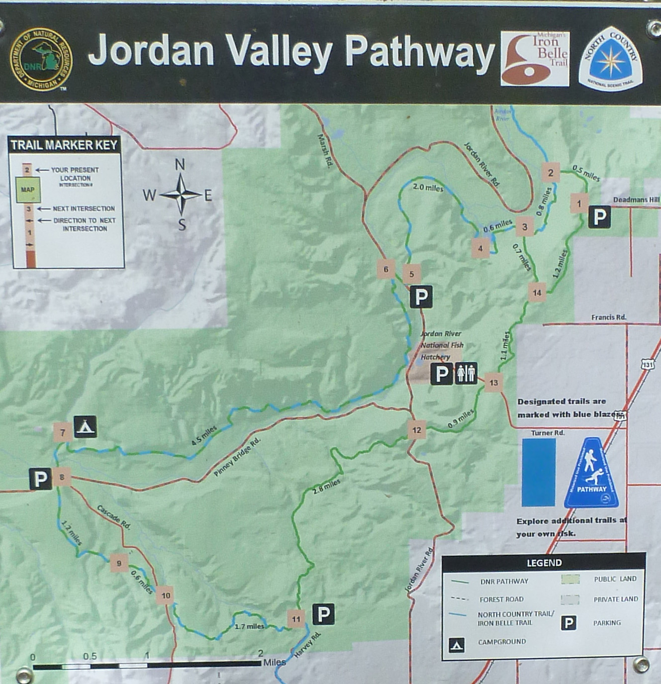
Current Trail Map
(Click on map to see a larger image)
On my most recent hike of the JRP (October, 2018), I took a GPS logger to record distance and elevation gain:
- The east side of the loop, hiking south from Deadman's Hill to Pinney Bridge Campground -- 10.6 miles, 1165 feet total elevation gain.
- The west side of the loop, hiking north from Pinney Bridge Campground to Deadman's Hill -- 9.2 miles, 1454 feet total elevation gain.
The Pinney Bridge Campground is the only place on the JRP that hikers can legally camp. It is a State Forest Campground so there is a nominal charge to stay there – $15 a night in 2018 (cash or check only). For that cost you get luxury accommodations (by backpacking standards). Each of the 15 campsites has a picnic table and fire ring. Separate vault toilets for men and women are stocked with toilet paper and hand sanitizer. A hand pump located at the central area is a source of potable water. There are waste barrels for trash.
Campsites are first-come, first serve. The only time I have seen the campground full to overflowing was a Saturday night during peak color season. I imagine there are a few other times that is also the case, but there is plenty of open space in or near the center of the campground where one can pitch a tent if necessary.
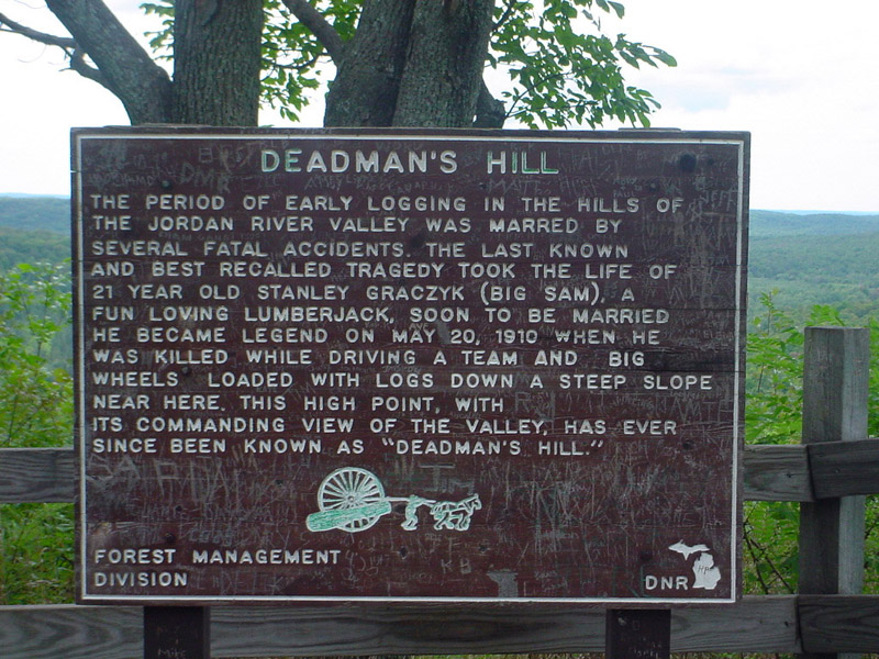
If one plans to spend the night at the Pinney Bridge Campground, the logical starting point for a JRP hike is Deadman’s Hill. The campground is located approximately half-way around the loop from there and hikers can leave their vehicles overnight in the Deadman’s Hill parking area.
There is no water at Deadman’s Hill so be sure to arrive with sufficient water to get you to the campground. For most people in most conditions, one liter should be enough; two liters more than enough. I always take some sort of water treatment just in case the pump at the campground is not working, in which case I would have to get water from the Jordan River. (That hasn’t happened yet. I don’t know if and when the pump is disabled for the winter.) And if I’m trying to minimize pack weight, I start with just a half-liter of water. There are plenty of streams along the way where I can replenish my water supply. (Always treat all water taken from streams.)
In my opinion, it doesn’t really matter whether you hike the east or west half of the loop first. I think the east half of the loop is more picturesque, which may be a factor in your choice. Hiking the west half first means walking down Deadman’s Hill at the start; hiking the east half first means ending your hike with a half-mile uphill. The distance to the campground along the west side is a bit shorter and therefore takes about a half-hour to an hour less time to cover. That may be significant if time is of the essence.
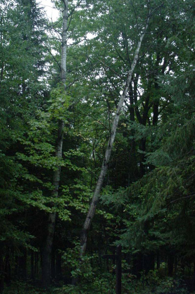
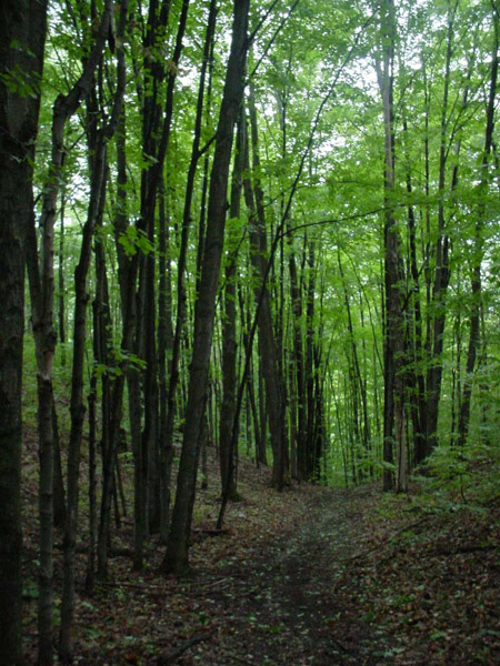
The trail is gentle on the feet – mostly forest duff and hard-packed sand. It goes up and down but only a few uphills are strenuous. Be careful on the boardwalks – they can be extremely slippery when wet. New trail markers have been erected recently so it’s simple to keep track of your location and direction of travel.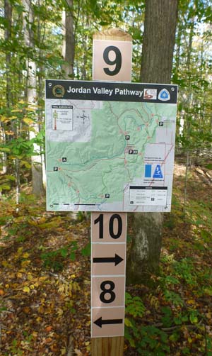
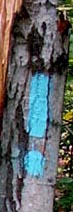 The trail is well worn and marked, making it easy to follow if you pay attention to the blazes. For much of the loop, the JRP and North Country Trail (NCT) are one and the same. The NCT is marked with vertical, rectangular blue blazes painted on trees; the JRP is blazed with blue dots or blue triangles. Where the two trails run together (most of the west half and the southern part of the east half), you will see both blazes – typically a blue rectangular blaze with a blue dot below it. The east half of the loop north of the Landslide Scenic View is just the JRP so that section of trail is only marked with blue dots and triangles.
The JRP is a great hike for beginners and a pleasant two day/one night getaway for backpackers of any experience level.
The Deadman's Hill trailhead is located about 15 miles west of Gaylord, MI in the northern part of Michigan's lower peninsula. For directions and more information, Google "Deadman's Hill Overlook Elmira Michigan directions."
***************
Trip Report
Click on any photo to see a larger image
Tuesday, September 13, 2005 (Graves Crossing campground)
After meeting for lunch, Jon and I drove up to the Graves Crossing state forest campground, which is located about 15 miles from the trail head. A "NO WATER" sign was posted at the entrance and a well drilling rig was set up a short distance inside. That gave us an excuse to drive into East Jordan to fill our water bottles and get some dinner.
East Jordan is known (but not very well) for two things. It is the home of East Jordan Iron Works, one of only a handful of companies in the United States that makes manhole covers. And Tommy Tropic claims it has the highest concentration (as a percentage of population) of professional jugglers in Michigan. I'm not sure that's true any longer. Crazy Richard has retired. That leaves just Tommy and Todd. Then again, it is a small town.
Returning to the campground, we self-registered and found a site with a level, grassy spot for our tent. Only one other site was occupied (by a RV). We had come mid-week to avoid the crowds. That part of our plan seemed to be working.
The sky, which had been clouding up during the afternoon, had cleared and the temperature was still in the 80s. Darn. A cold front bringing rain was on its way. We had hoped it would be here by now. The later it came through, the greater the likelihood we would be hiking in rain tomorrow. Oh, well. When life serves you lemonade, drink it. We started a campfire and lazed around talking and reading.
Around 8:30 p.m. flashes of lightning in the western sky disabused us of any notion that the faint rumbles we had been hearing were road noise. The approaching storm teased us for more than an hour.
It hit shortly after we had gone to bed. Laying there in the dark, it sounded like a series of waves breaking over us: beginning as the murmur of distant surf, increasing in volume and intensity as the wave sped toward us, rose higher, and began to curl, culminating in the roar of whitewater cascading down on our heads, the noise fading as it rolled on past. A brief lull. Then another wave. And another. Pouring rain drummed on the rainfly, but the tent never flapped or shook. The wind whipped through the treetops yet it remained calm at ground level.
Wednesday, September 14, 2005 (Deadman's Hill to Pinney Bridge campground -- west side of the loop, 8 miles)
 Morning brought a slate gray sky and intermittent showers. We packed our gear between raindrops and tossed the wet tent into the Suburban. Just before leaving, Jon noticed that a tree on the east side of our campsite, which had been perfectly vertical last night, now tilted at an angle away from (fortunately) where our tent had been.
We drove back into East Jordan for a leisurely breakfast and to wait for the trailing edge of the front to pass. The temperature had dropped five degrees since waking and was down to 65 when we finally left for the trail head. Although the sky was still overcast, a lighter band of gray on the western horizon heralded better weather. By the time we had checked out the view from the Deadman's Hill overlook, sorted and packed our gear, and parked the Suburban, the rain had ended.
 |
 |
 |
The Jordan River Pathway is an 18 mile loop. Pinney Bridge campground, where we planned to overnight, was eight miles in one direction and 10 in the other. Since it was already 11:00, we opted to start with the shorter section.
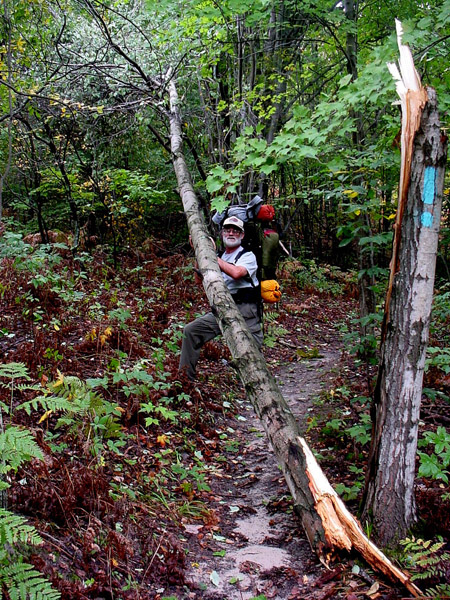 The trail down Deadman's Hill was steep. Downhill was good. Turning south at the base, we hadn't gone far before encountering a blowdown across the trail. The break was fresh; perhaps a result of last night's storm. Jon attempted some trail maintenance but the tree was too heavy for him to move by himself and I couldn't help because I was taking his photo. Where's Arnold when you need him?
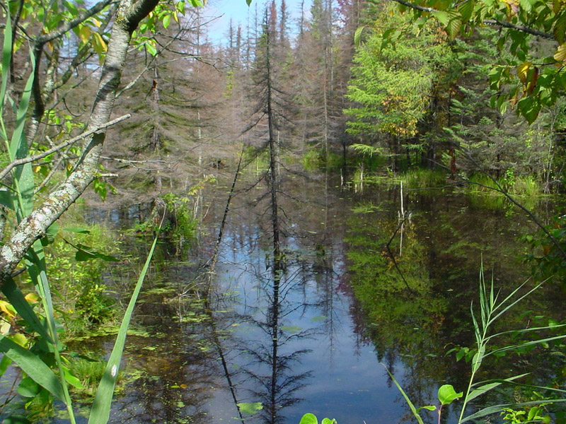
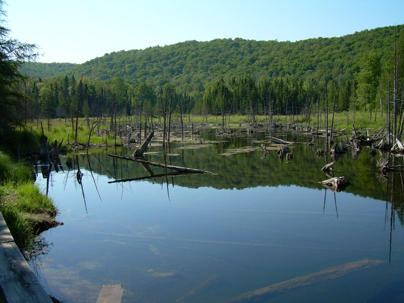
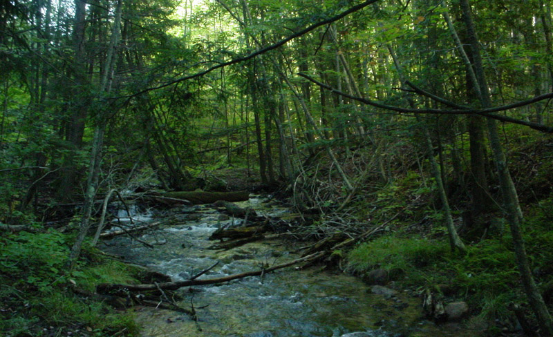
A mile or so into the hike, we came to a spot where the trail was covered by eight inches of water. Not a good omen. But it looked more like flooding caused by a beaver dam than by the recent rain. We were able to bushwhack around it, avoiding the need to remove our boots and socks and go wading.
The trail ran between scenic ponds and bogs then climbed upward. I asked Jon how he was doing. "Except for the shortness of breath, heart palpitations, and lightheadedness, I'm fine," he joked.
 |
 |
 |
 |
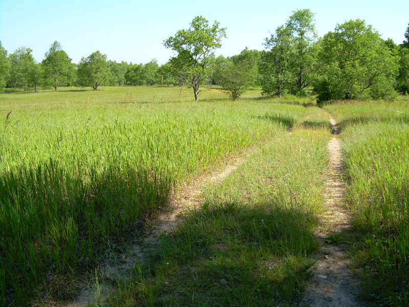
In reality, it was easy hiking. A few ups and downs but mostly level and smooth and quite a bit of two-track trail. "Like a city or county park," I noted.
"A pathway, not a trail," Jon agreed.
 |
 |
 |
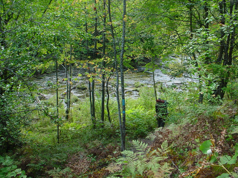
 We crossed the Jordan River. From the maps I had obtained, I had pictured the trail running south along or near the bank of the river from this point. Instead, it headed inland before winding back to the river. Around 2:00, we stopped for lunch at an open, flat area on the riverbank. Rushing water gurgled over and around rocks and deadfalls. The sun had broken through and the sky was a mottled gray, white, and blue. It was a peaceful spot.
All too soon it was time to go. We had just put on our packs when the moment was shattered by the loud VROOM ...... VROOM ....... VROOM of a diesel engine sputtering to life then settling into a dull roar. So much for the illusion of being away from it all.
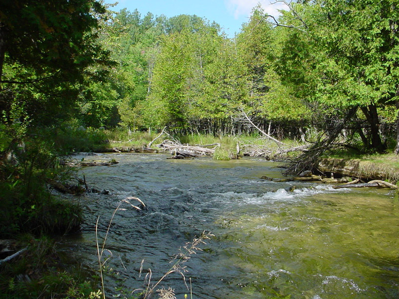
The trail paralleled the river for only a short distance before again turning inland. This time it stayed there. It was pleasant enough, but not what I had anticipated.
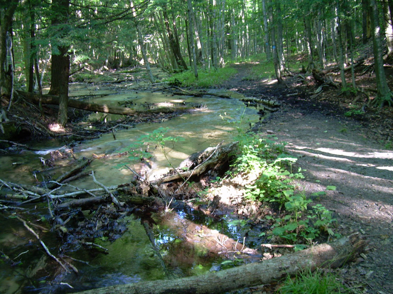
 We arrived at the Pinney Bridge campground at 4:15. It is a hike-in only campground with 15 campsites that form a loop around a large, mostly grassy center containing two pit toilets, a water pump, and a registration station/bulletin board. The fee is $10 (now $15) per night. "Ten point one million people live in Michigan and we're the only two here," Jon observed.
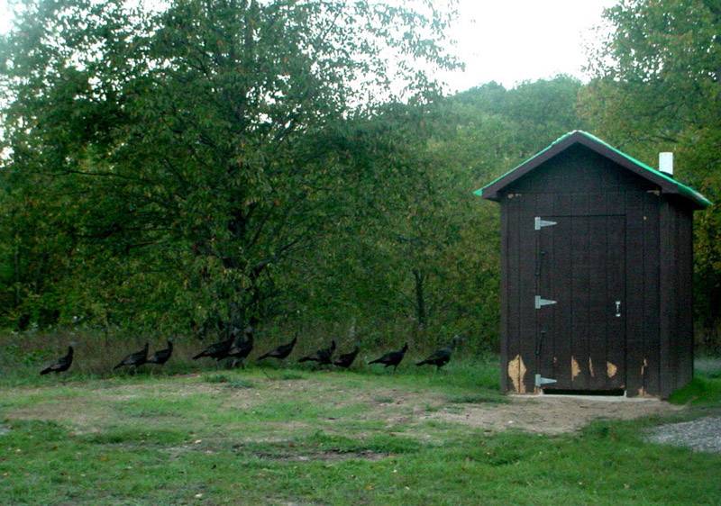
After pitching our tent and unpacking our gear, we went exploring. Campsite Number 15. Campsite 14. Campsite 13.... Apples littered the ground at the entrance to Campsite 2. Was the campground on the site of an old orchard? Some wildlife sign. Gnawed wood along the bottom of the toilet doors and walls. Scat and, later, the flock of wild turkeys that left it. The Jordan River running under Pinney Bridge.
Thursday, September 15, 2005 (Pinney Bridge Campground to Deadman's Hill -- east side of the loop, 10 miles)
Up at 7:00 a.m. It was cold -- 43 degrees. The dew was so heavy the tent was as wet as if it had been raining. The sky was perfectly clear but the sun wouldn't make it over the treetops in time to dry off the tent before we left.
Freeze dried scrambled eggs with baco bits for breakfast. Jon thought they tasted okay after the fourth bite. I hadn't achieved that state of mind by my last bite. The aftertaste gave me an opportunity to reconsider. Nope. Can't agree with him.
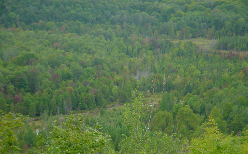
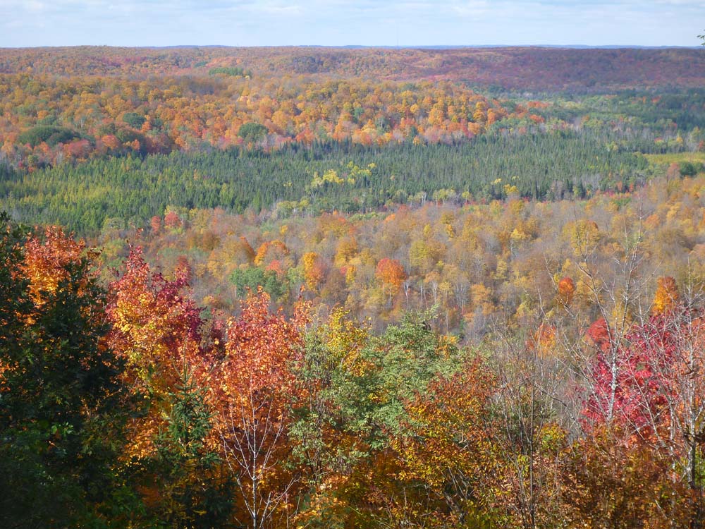
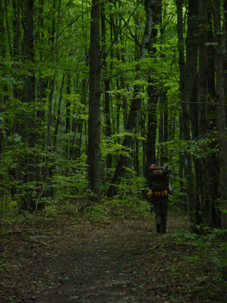
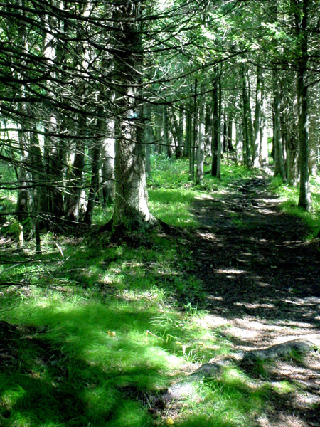
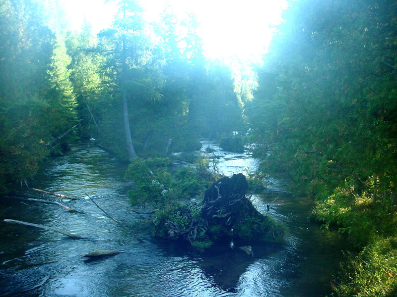
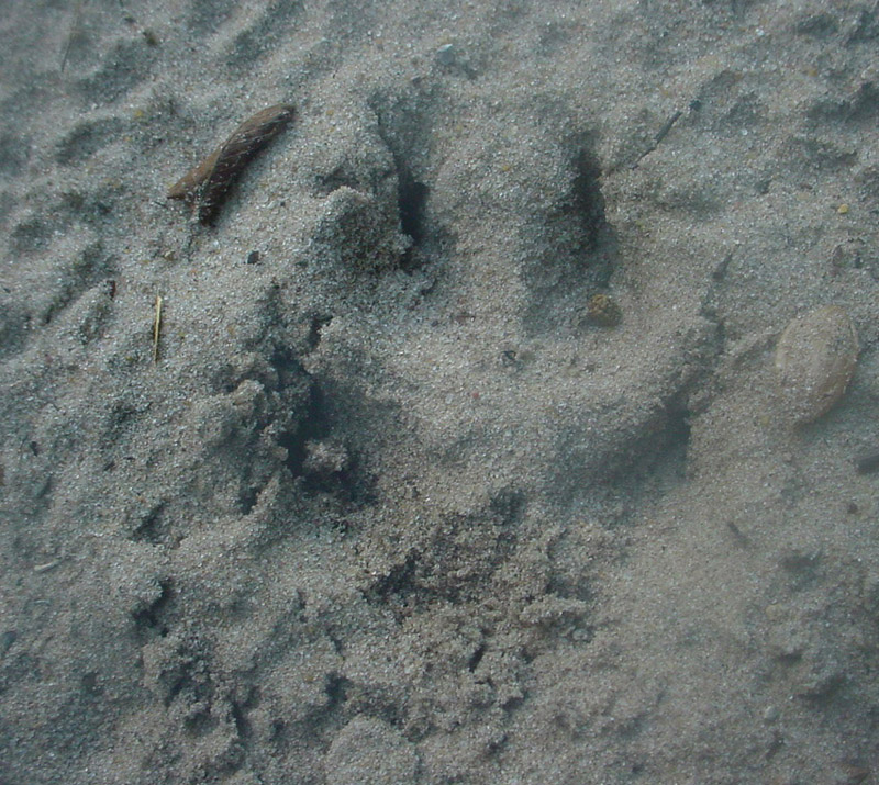
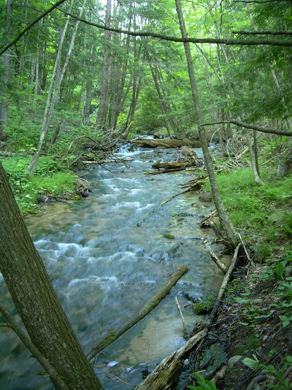
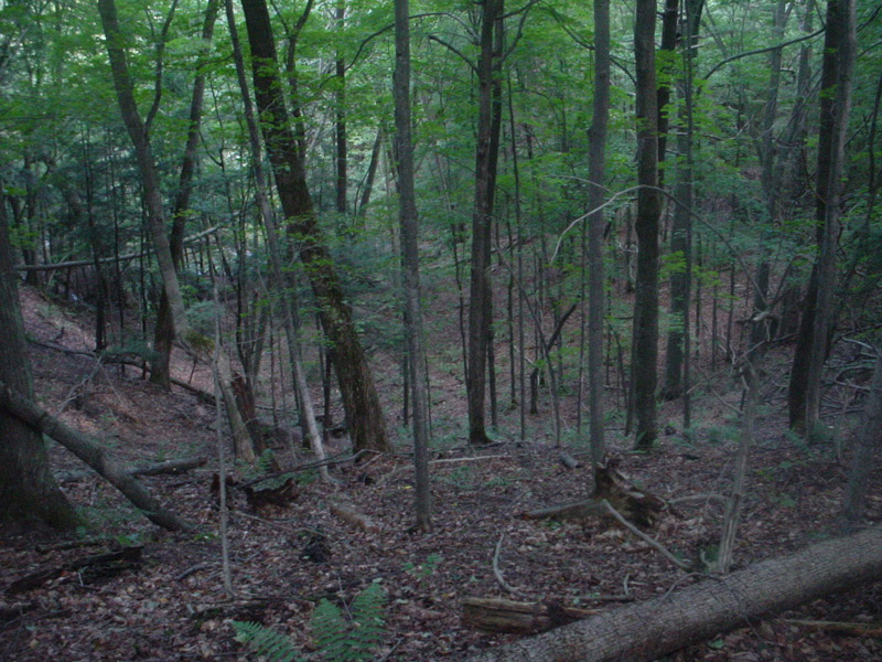
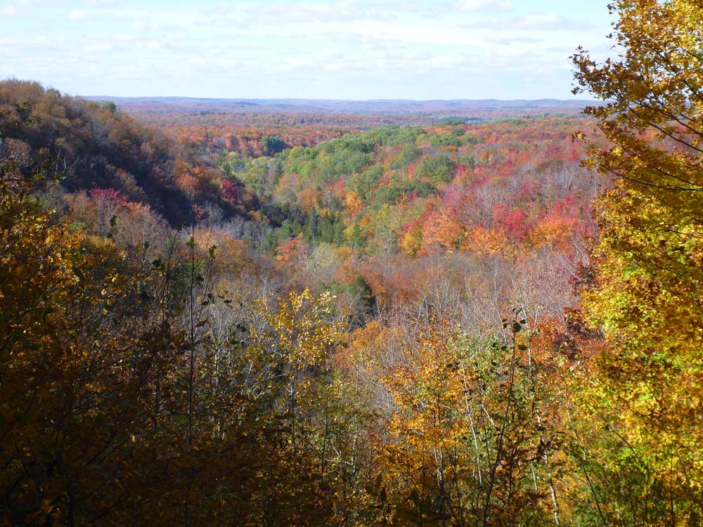
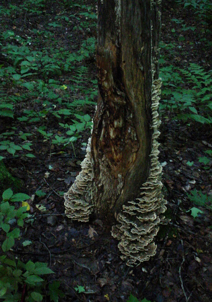
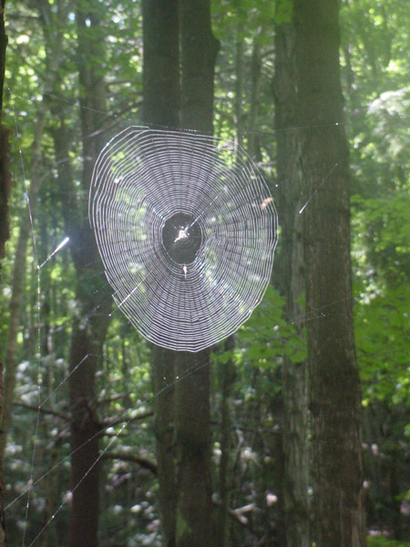
We hit the trail shortly before 9 a.m. And it was a trail this time, not a pathway. The seven mile stretch between Pinney Bridge and Jordan River Road turned out to be my favorite. It ran primarily through second (or third or fourth?) growth forest, but offered plenty of variety. Lots of ascents and descents, some of which had us breathing heavily. (From exertion. This is a "G" rated trip report.) A few clearings. At one point, fresh scat in the middle of the trail and what looked like canine paw prints. Ridges with steep dropoffs. A cluster of white pines with trunks that dwarfed the younger trees around them. Blowdowns and deadwood decorated with fungi littering the forest floor. The Landside scenic view overlooking the river valley. A grove of spruce trees. Spider webs glistening in the sunlight. The many creeks.
 |
 |
 |
 |
 |
 |
 |
 |
A group of four elderly people was enjoying the view from Deadman's Hill when we trudged in at 2:00 p.m. They asked about our hike and we chatted briefly. As they were walking away, one of the women suddenly turned around and asked "How old are you guys?"
"I'm 57, he's 63," I answered.
"Oh. You're young."
When they were out of earshot, Jon commented "Twenty years ago if someone had asked me whether I would still be hiking at 63, I'd have said ‘No way!'"
"It was a good hike, wasn't it?"
"Yeah. What's our next one?"
David Guenther