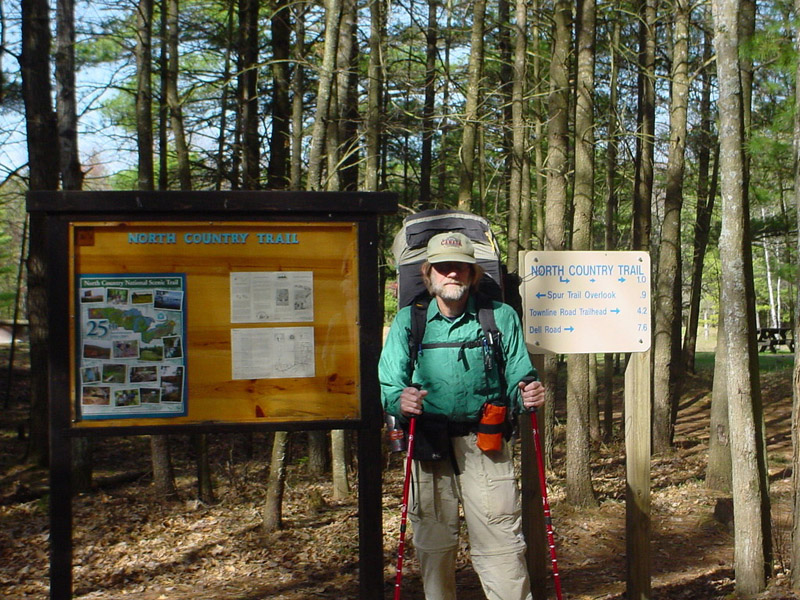
Old US 131 SFCG to Red Bridge Access
Click on any photo to see a larger image
This was a training/shakedown/I need a break from working on the house/take advantage of a weather window hike. The plan was to start off with a relatively easy 10 mile day followed by three consecutive 13-14 mile days. That’s not quite how it worked out.
My pack was jammed with gear and food and weighed 50 pounds. The milage and weight were intentional. I wanted to push myself. Sometime before mid-July I am going to start thru-hiking the Appalachian Trail. For the past month I have been doing training hikes – three to six miles a day, three or four days a week, with a 30+ pound pack. But that’s a long way from averaging 12 miles a day for six months. I wanted to find out how ready I was and what final adjustments I needed to make.
Tuesday, April 18, 2006 – Old US 131 SFCG to Baxter Bridge SFCG, 15 miles
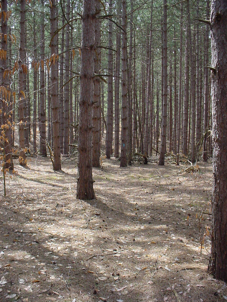
 My ride dropped me off at the Old US 131 SFCG at 10:30 a.m. For the first mile-and-a-half, everything went according
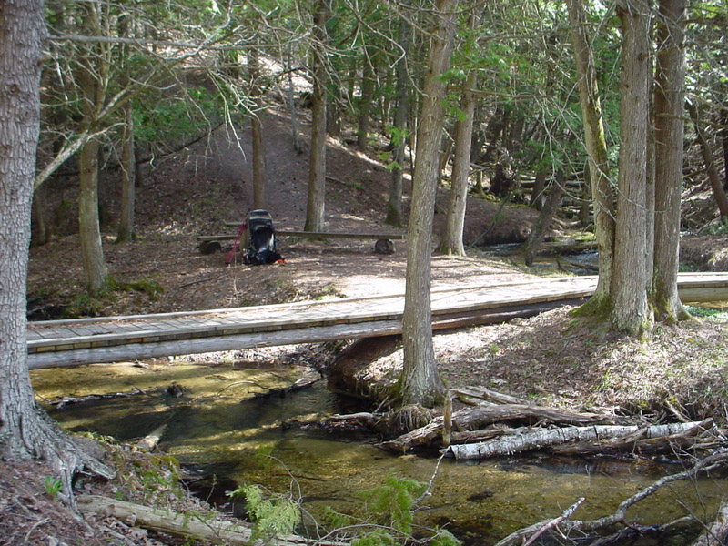
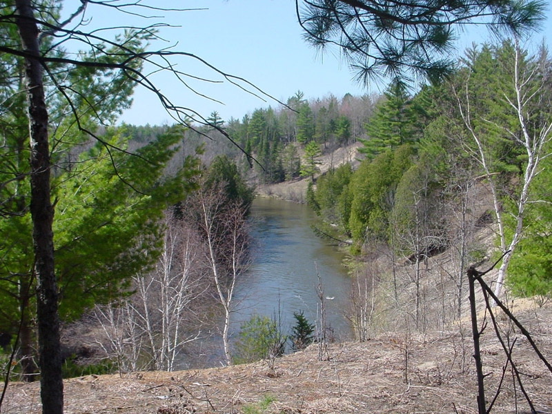
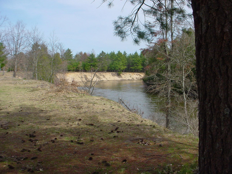
to plan. Hiking conditions were ideal – 57* F, a cloudless blue sky, and a gentle breeze. The trail wound through evergreens along the bank of the Manistee River. Sunlight dappled a
forest floor carpeted with pine needles and autumn leaves. A footbridge crossed two creeks that converged in a “Y.” The flat land nestled between the arms of the “Y” looked to be a
lovely spot to camp. I lingered, but not too long. It was still early and I had miles to go. Little did I know how many.
My ride dropped me off at the Old US 131 SFCG at 10:30 a.m. For the first mile-and-a-half, everything went according
to plan. Hiking conditions were ideal – 57* F, a cloudless blue sky, and a gentle breeze. The trail wound through evergreens along the bank of the Manistee River. Sunlight dappled a
forest floor carpeted with pine needles and autumn leaves. A footbridge crossed two creeks that converged in a “Y.” The flat land nestled between the arms of the “Y” looked to be a
lovely spot to camp. I lingered, but not too long. It was still early and I had miles to go. Little did I know how many.
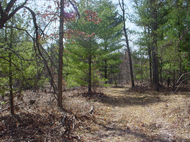
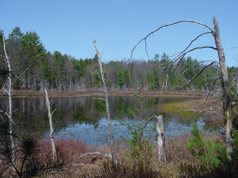
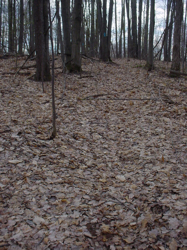
The trail paralleled one of the creeks, crossed it, then zigzagged inland, becoming mostly two-rut that ran through stands of pine and airy mixed woods littered with cut downs and blow downs. Some of the deciduous trees were starting to leaf out. A picturesque bog appeared on the left.
 |
 |
 |
Lots of deer tracks were visible in the sandy soil. But many had recently been obliterated by another type of track. I started paying closer attention to my surroundings and, sure enough, a short time later I caught a brief glimpse as first one, then a second, ATV sped across the trail 20 yards in front of me. I remained quiet and still. They never realized I was there.
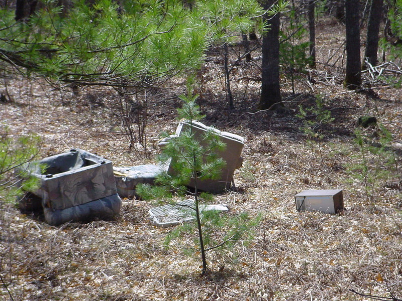
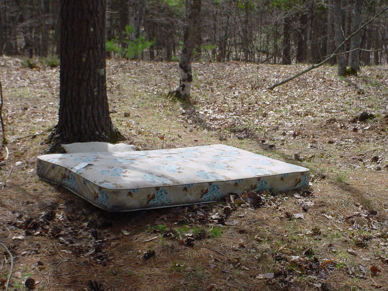
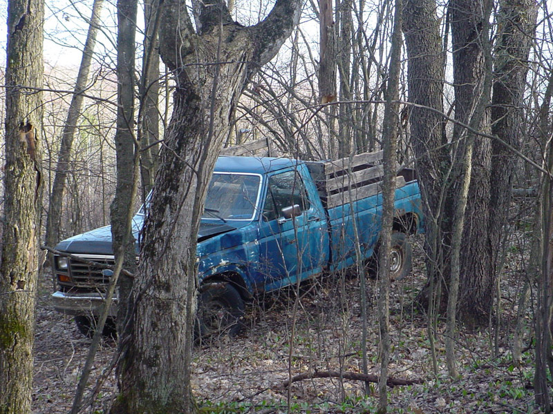
The trail turned east, becoming single-track again, and ran along an old railroad grade. On the right, someone had dumped a couple of overstuffed chairs, a box fan, and a microwave. Sadly, this was not the first nor last pile of refuse I passed. If I wasn’t picky, I could have obtained a vehicle and made a good start on furnishing a house with what others had disposed of near the trail. The good news, I suppose, is that I didn’t stumble across a meth lab.
 |
 |
 |
The bad news, however, was that something was wrong. I shouldn’t have been going east. According to my map, the trail headed north from the Old US 131 SFCG then turned WEST. Still, at this point, it was probably worth following the blazes a little longer to see if I came across a landmark that would allow me to fix my location.
Fifteen minutes later I saw cars rushing past the gap in the trees made by the trail. I broke out of the woods onto a road and saw a NCT trail marker and map. My initial elation quickly plummeted. S**t! I was at M-113, four miles north of where I started, on a section of trail and in a county that weren’t on my map. Rather than backtrack and try to find a trail junction that I had already missed once, I decided to work my way west and south on the roads until I picked up a feature that fixed my position.
I followed M-113 northwest for half a mile, then turned west on Walton Road. The “Pugsley Correctional Facility” sign at the intersection gave me pause. As I passed the correctional facility I was tempted to go to the office and ask for directions but wondered what reaction that would generate. I wasn’t that lost – yet. So I walked on by.
The inmates were out in the yard, which was separated from the road by a high chain-link and razor wire fence. “Hi,” one of them called out to me.
“Hi,” I responded – from the opposite side of the road.
“Would you throw me a rope?” Laughter.
“I don’t think that would be a good idea.”
“Do you have any money?”
“Not much.” Okay. So my repartee left something to be desired.
“[Inaudible.]”
“Say again?” I was almost out of earshot. Normally, I would consider it impolite to walk out in the middle of a conversation. But proper etiquette and witty banter were not a high priority right then. I kept on walking.
A mile past the correctional facility a woman was working in her front yard, cleaning out a couple of small ponds. “Hi,” I greeted her.
“Hi.”
“I’m lost. Can you tell me where I am?”
“Where are you headed?”
“Baxter.”
“That’s a long way from here.”
“I left the US 131 State Forest Campground this morning to hike the North Country Trail along the Manistee River but made a wrong turn. Can you tell me how to get back to the river?”
“Turn left at the corner just up the road. There’s a sign for the trail. But the river is three or four miles back in. Help yourself to some water. I’ll get a map.”
Then, Trail Magic! Barb offered to drive me to the trail head. As we rode down the deeply rutted dirt road, she joked “People will think I’m crazy giving a man I don’t know a ride into the woods.” She dropped me off at a NCT sign at a fork in the road and I thanked her. It turned out it was another mile down the right fork to the trail head. But I wasn’t complaining. Barb’s kindness had just saved me a good three miles of walking.
I estimate I skipped about 2 miles of river trail and that my longcut took me 10 miles (seven of which I walked) to cover the same distance. On the bright side, my alternate route took me through Riplows Marsh where I got to see scenery I otherwise wouldn’t have. So what if I had missed a few river views. There were plenty more to come.
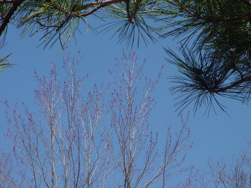
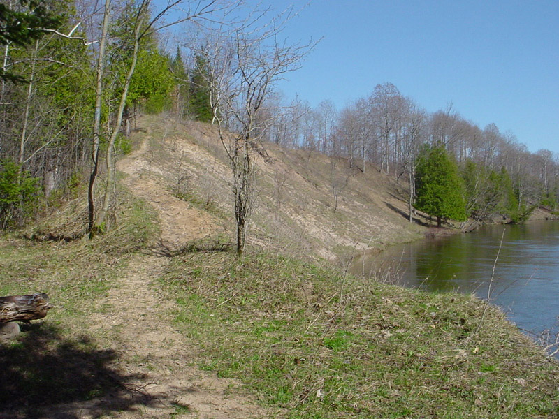 The trail ran along high bluffs overlooking the river, descended and climbed narrow footpaths cut into the sides of deep ravines, and followed the bank at river level. Patches of burgundy
and lime brightened the drab vistas; spring was revealing its colors. But I couldn’t stop for as long as I wanted to admire the views. I was pushing to make up for lost time and miles.
The trail ran along high bluffs overlooking the river, descended and climbed narrow footpaths cut into the sides of deep ravines, and followed the bank at river level. Patches of burgundy
and lime brightened the drab vistas; spring was revealing its colors. But I couldn’t stop for as long as I wanted to admire the views. I was pushing to make up for lost time and miles.
 The last three miles were roadwalk. The temperature had risen to the mid-70s and it was a grueling slog in the blazing sun after a long day. It seemed that every other house had at least one
dog which barked in protest as I walked by. A german shorthair pointer charged across the road to me. “Don’t worry, he’s friendly,” the owner assured me. I’ve heard that before. Fortunately,
this time it was true. A teenager riding his bicycle stopped for a brief chat. Of the many vehicles that passed me, all but a few ignored my presence even when I waved.
The last three miles were roadwalk. The temperature had risen to the mid-70s and it was a grueling slog in the blazing sun after a long day. It seemed that every other house had at least one
dog which barked in protest as I walked by. A german shorthair pointer charged across the road to me. “Don’t worry, he’s friendly,” the owner assured me. I’ve heard that before. Fortunately,
this time it was true. A teenager riding his bicycle stopped for a brief chat. Of the many vehicles that passed me, all but a few ignored my presence even when I waved.
Shortly before 7:00 I dragged into Baxter Bridge State Forest Campground. Not surprisingly, I had it all to myself. What should have been a leisurely 10 mile day had become an exhausting 15 mile one. I’m a night person but that evening I crawled into bed as soon as my chores were done.
Wednesday, April 19, 2006 – Baxter Bridge SFCG to Wheeler Creek, 15-21 miles
Up at 7:00 a.m. The temperature was 32* F. Besides being a night person, I dislike the cold. So I was moving in slow motion – too awake to go back to sleep and too asleep and chilled to move quickly. Like a cold blooded reptile, my metabolism increased with the temperature. By 10:00 it was 58* and I was finally ready to head out.
While walking the half-mile to the trail head, I was thinking that, after yesterday, today’s 13 mile hike to Wheeler Creek would seem easy. Awww, s**t! (That was twice in two days and I rarely swear.) The sign at the trail head said it was 20.5 miles to Wheeler Creek. Then a glimmer of hope. Someone had drawn a line through that milage figure and hand-written “14.7" beside it. So how far was it to Wheeler Creek -- 13, 14.7, or 20.5 miles? Not that it really mattered. Whatever the distance, I had to cover it. But to play it safe, I was going to have to push it – again.
The teenager I talked to yesterday told me the hills just west of the trail head were known as the “Holy Rollers.” I found out why -- lots of steep ups and downs, but mostly ups. I paused frequently to catch my breath. But never for long. I couldn’t afford to dally.
“Why are you beating your head against the wall?”
“Because it feels so good when I stop.”
 That old joke popped into my head and wouldn’t leave. It contains an element of truth. There are times that hiking is difficult, uncomfortable, and even painful, and I find myself asking
“Why am I doing this?” or complaining about the terrain, the weather, an obstacle, bugs, a jerk, or some other irritation. But then I stop and doff my pack and let my surroundings seep in.
And my mood abruptly changes. There is something about a panoramic view, a burbling creek, or the quiet of the woods that instantly displaces the hardships leading up to that moment
with a feeling of serenity and joy that soothes the soul. And so it was when, three hours later, I arrived and took a break at the Highbanks Rollway, the highest point along the
Manistee River. It was all downhill (at least figuratively) from there.
That old joke popped into my head and wouldn’t leave. It contains an element of truth. There are times that hiking is difficult, uncomfortable, and even painful, and I find myself asking
“Why am I doing this?” or complaining about the terrain, the weather, an obstacle, bugs, a jerk, or some other irritation. But then I stop and doff my pack and let my surroundings seep in.
And my mood abruptly changes. There is something about a panoramic view, a burbling creek, or the quiet of the woods that instantly displaces the hardships leading up to that moment
with a feeling of serenity and joy that soothes the soul. And so it was when, three hours later, I arrived and took a break at the Highbanks Rollway, the highest point along the
Manistee River. It was all downhill (at least figuratively) from there.
By 2:00 p.m. I had descended to river level and was enjoying a level walk along the bank. By 3:00 I was wondering where Anderson Creek was. My map said it was 8.7 miles from the trail head and I had already gone farther than that. All the contradictory milage figures had screwed up my reckoning.
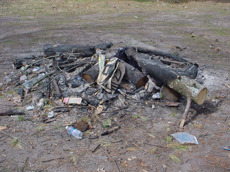 Oh, well. Wherever I was, it was a beautiful spot for a long break – a wide, flat expanse of sandy soil sprouting patches of grass and studded with tall pines. Sitting near the edge of the
bank, my back resting against a tree trunk, gazing out over the river, I could pretend the remnants of bonfires and the trash strewn about behind me didn’t exist.
Oh, well. Wherever I was, it was a beautiful spot for a long break – a wide, flat expanse of sandy soil sprouting patches of grass and studded with tall pines. Sitting near the edge of the
bank, my back resting against a tree trunk, gazing out over the river, I could pretend the remnants of bonfires and the trash strewn about behind me didn’t exist.
A too short hour later, it was time to go. Anderson Creek turned out to be just 15 minutes down the trail. I was almost out of water so stopped just long enough to filter a liter.
 That marked the end of the riverwalk. Now the trail headed inland and upward. At places, the path was faint and the blazes were sparse and I had to pause to get my bearings. Yesterday was
fresh in my mind and it was too late in the day to afford a mistake. Finally, at 7:00 p.m., after nine hours of hiking, I arrived at Wheeler Creek. Assuming an average of two mph, I’d
traveled 18 miles. But it could have been as few as 15 or as many as 21.
That marked the end of the riverwalk. Now the trail headed inland and upward. At places, the path was faint and the blazes were sparse and I had to pause to get my bearings. Yesterday was
fresh in my mind and it was too late in the day to afford a mistake. Finally, at 7:00 p.m., after nine hours of hiking, I arrived at Wheeler Creek. Assuming an average of two mph, I’d
traveled 18 miles. But it could have been as few as 15 or as many as 21.
There was a great campsite on top of a promontory located between a horseshoe bend in the creek. The gurgling water serenaded me in stereo. A short path down the slope led to a spot I could filter water. The site even had a developed fire pit. But I was too tired to start a fire. I was even too tired to cook. So I ate a cold supper and hit the sack.
In the middle of the night I woke up thinking I smelled the whiff of a skunk. After a moment, I realized it was only me and rolled over and went back to sleep.
Thursday, April 20, 2006 – Wheeler Creek to Seaton Creek Campground, 19 miles
I awoke at 7:00 a.m. to a temperature of 37*F. The eastern sky was clear and the rising sun was struggling to reach me through the trees. However, a gray blanket of clouds was sliding in from the west. The threat of rain trumped the early hour and morning chill, prompting me to hustle (relatively speaking). I had broken camp, eaten a hot breakfast, filtered water, and was in the final stage of loading my pack when it began to drizzle.
Today’s hike began with a 4.5 mile roadwalk so I welcomed the “shade” of the overcast. For the first couple of hours, the intermittent drizzle and occasional rain showers had me guessing whether and when to wear my rain jacket. I usually guessed wrong. Shortly before noon, Zeus tired of playing mind games with me and went elsewhere in search of entertainment. The remainder of the day was partly cloudy, dry, and pleasant.
 At 1:30 p.m. I stopped for lunch at a peaceful spot in the middle of a pine woods. A little over an hour later I arrived at a roadside park where the trail crossed M-115. Garbage cans! Yeah!
I finally got rid of the two-and-a-half days of trash I was carrying. I also used the pump to fill my almost empty water bottles and the restroom to empty my almost full bladder.
At 1:30 p.m. I stopped for lunch at a peaceful spot in the middle of a pine woods. A little over an hour later I arrived at a roadside park where the trail crossed M-115. Garbage cans! Yeah!
I finally got rid of the two-and-a-half days of trash I was carrying. I also used the pump to fill my almost empty water bottles and the restroom to empty my almost full bladder.
Just past the park was a two mile roadwalk. While passing a house at the halfway point, a Saint Bernard appeared from behind the house and charged across the road toward me, growling and semi-circling. It dropped back, allowing some distance to open up between us, then once again sprinted toward me, woofing and growling. Its owners were nowhere to be seen. Roadwalks are for the dogs.
 Around 5:00 p.m. I came to the first of two creeks that I had marked as potential campsites on my map. It was a barely moist furrow in the ground. A while later I crossed the second creek.
It had water but would more accurately be characterized as stagnant than flowing. I had already gone 14 miles but, since there were still four hours of daylight remaining, I decided to tackle
the five miles to the Seaton Creek Campground.
Around 5:00 p.m. I came to the first of two creeks that I had marked as potential campsites on my map. It was a barely moist furrow in the ground. A while later I crossed the second creek.
It had water but would more accurately be characterized as stagnant than flowing. I had already gone 14 miles but, since there were still four hours of daylight remaining, I decided to tackle
the five miles to the Seaton Creek Campground.
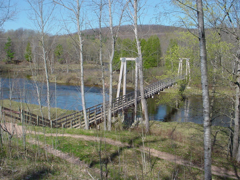 A hour later I left the North Country Trail and headed back the way I had come on the Manistee River Trail. The NCT ran along the west side of the Manistee River and the jog north was necessary
to reach the suspension bridge and cross over to the more picturesque (I was told) MRT.
A hour later I left the North Country Trail and headed back the way I had come on the Manistee River Trail. The NCT ran along the west side of the Manistee River and the jog north was necessary
to reach the suspension bridge and cross over to the more picturesque (I was told) MRT.
I like hiking at dusk. The heat of the day is past and the relative cool of the evening is invigorating and restorative. As a night person, my biological clock is operating in high gear. And it’s a time that wildlife begins to move around. A flock of turkeys hurried across the trail 25 yards in front of me. Zoned out, I missed the blazed trail that veered to the left and followed another trail that dead ended on the river. The half-mile side trip was worth it. As I descended a steep slope into a swale, I was treated to the sight of two magnificent whitetail deer.
I backtracked, picked up the correct trail, and headed down the final stretch. About a mile from the campground, I encountered a family of three and their two beagles out for an evening stroll. The beagles howled and lunged at me, restrained only by their leashes. The owners had to work at keeping them under control and back far enough so I could pass safely.
“I didn’t think I looked like a rabbit,” I gibed as I walked by.
“They’re just being protective,” was the response.
I’m a dog person. I’ve owned a beagle. Those were not beagles. They were pit bulls in disguise.
 At 7:40 p.m. I reached the campground. My feet hurt and I was out of water and thirsty. I looked for the pump that was supposed to be there and didn’t see it. Turning right, I began hobbling
around the circle drive, carefully scanning every nook and cranny and campsite. I passed two pit toilets and another structure. No pump. I checked out the picnic area. No pump. After coming
almost full circle, still no pump. My frustration and anxiety were growing. I needed water! Where’s the pump!? Finally, less than 10 feet from where the trail entered the campground, I found
it. If I had just focused my attention left when I arrived, I would have seen it. That’s what I get for being a right-handed person in a right-handed world.
At 7:40 p.m. I reached the campground. My feet hurt and I was out of water and thirsty. I looked for the pump that was supposed to be there and didn’t see it. Turning right, I began hobbling
around the circle drive, carefully scanning every nook and cranny and campsite. I passed two pit toilets and another structure. No pump. I checked out the picnic area. No pump. After coming
almost full circle, still no pump. My frustration and anxiety were growing. I needed water! Where’s the pump!? Finally, less than 10 feet from where the trail entered the campground, I found
it. If I had just focused my attention left when I arrived, I would have seen it. That’s what I get for being a right-handed person in a right-handed world.
I set up camp and relaxed, enjoying the enveloping darkness. Except for my feet, I felt good, a satisfying tiredness instead of the weary exhaustion of the previous two nights. I checked my feet. On the ball of each was a single blister smaller than a dime. I should have stopped and taken preventative measures when I first felt the hot spots, but getting to the campground before dark seemed more important at the time. I would pay the price tomorrow. The blisters were small, but they hurt! They were located right where the ball of my foot exerts maximum pressure when walking. But I only had 11 miles to go. After the past three days, I could easily limp that distance.
Friday, April 21, 2006 – Seaton Creek Campground to Red Bridge Access, 11 miles
I had saved the best for last and ended up with plenty of time and beautiful weather to enjoy it. Once again I was up at 7:00 a.m. The temperature was 37*F, the winds calm, and the sky cloudless. My pickup at Red Bridge was scheduled for 6:00 p.m. That gave me 11 hours to cover 11 miles.
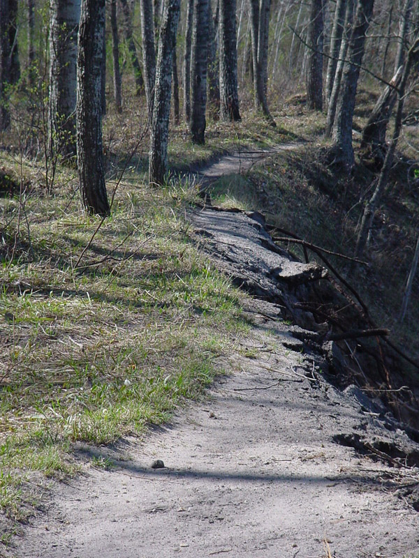
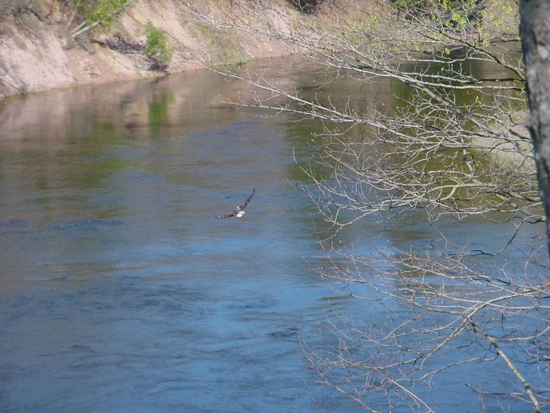 I took my first break at a high bank overlooking the Manistee River. The bank had recently collapsed, taking a short segment of the trail with it. As I sat there, an eagle swooped in and
landed in a thicket of trees just to the south. I grabbed my camera and tried to sneak close enough for a photo. The eagle spooked, flew down to river level and headed north.
I took my first break at a high bank overlooking the Manistee River. The bank had recently collapsed, taking a short segment of the trail with it. As I sat there, an eagle swooped in and
landed in a thicket of trees just to the south. I grabbed my camera and tried to sneak close enough for a photo. The eagle spooked, flew down to river level and headed north.
A half-hour later, I was sauntering along the trail, thinking about the wildlife I had seen and heard on this hike. Ducks. Geese. Hawks. Grouse. Turkeys. Deer. An eagle. More often heard than seen. I reminded myself to spend less time looking down at my feet and more time watching my surroundings. Ironically, that is why I didn’t see the woodcock squatting in the middle of the trail until it was practically underfoot. Not wanting to be trampled by a giant, it took off into the woods.
A few minutes and 100 yards later, I met a guy walking two pit bulls. From woodcock to pit bulls. What a juxtaposition. The dogs were leashed, well behaved, and friendly, and the owner courteously stepped off the trail to let me pass. Personally, I suspect Zeus was playing games again and had done a beagle-pit bull mind switch to tease me.
The rest of the day was delightfully uneventful and scenic. For the most part, the trail paralleled the river, offering one splendid view after another. Over the previous three days I had only twice encountered people on the trail. Today, I ran into someone at least once an hour. I hope they enjoyed their hikes as much as I did mine.
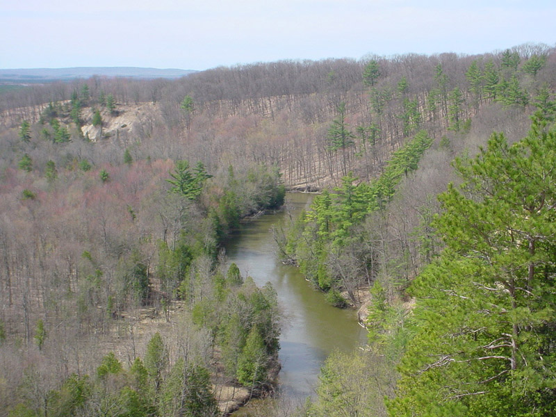
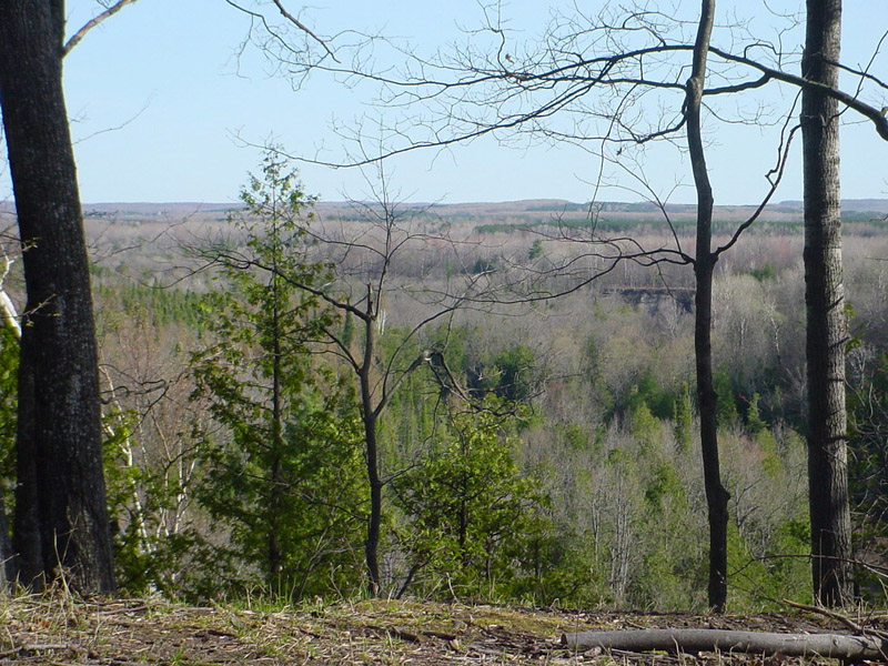
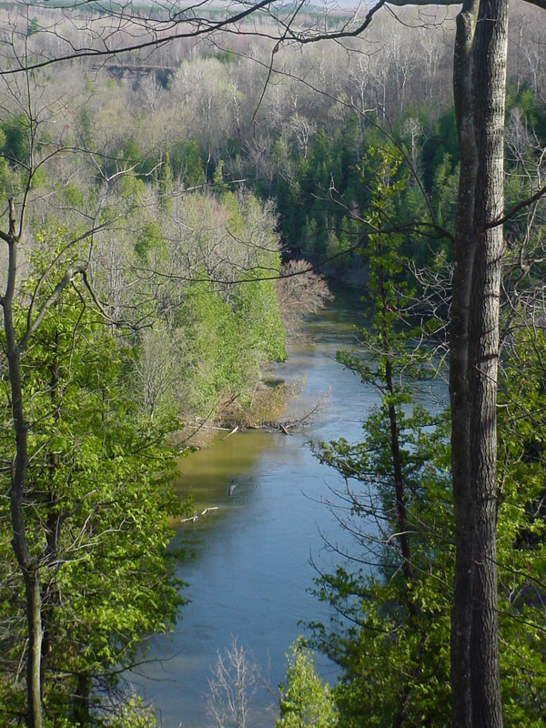
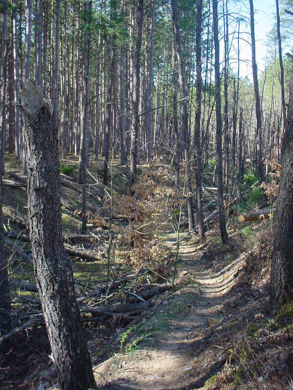
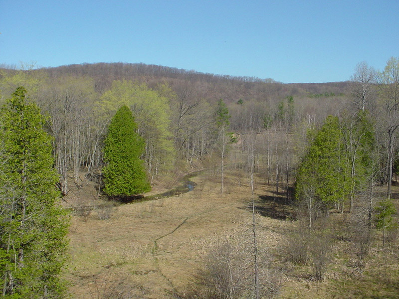
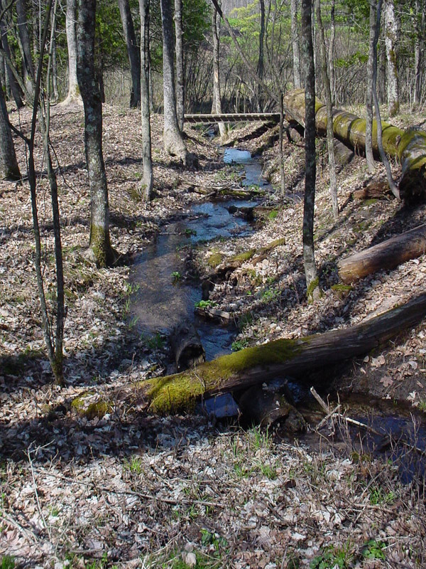
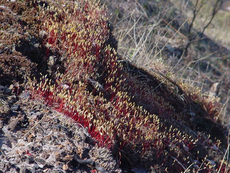
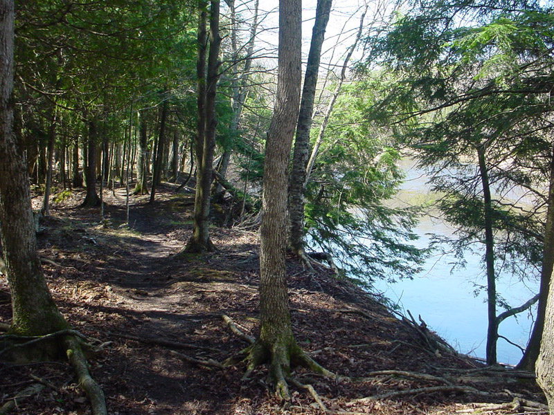
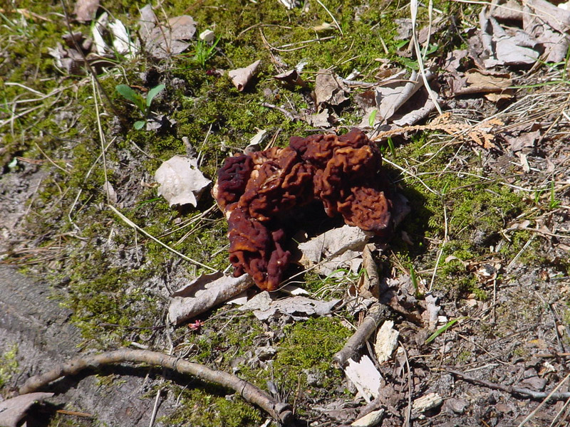
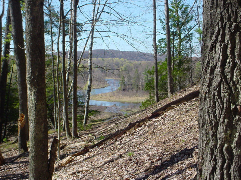
A few of the other sights along the Manistee River Trail:
 |
 |
 |
 |
 |
 |
David Guenther